Table of Contents
- Introduction
Case Studies
- Introduction
- Ed Roberts Campus
- Gallaudet University 6th Street Development
- Skyler
- Black Women Build
- New Swampscott High School and Senior Center
- Las Abuelitas Kinship Housing
- Side by Side
- Disability × Maternity: A Household User’s Manual for Young Mothers with Disability
- Carehaus
- 11th Street Bridge Park
- North Philly Peace Park
- Table Top Apartments
Aging Against the Machine
Block Party: From Independent Living to Disability Communalism
Decolonizing Suburbia
Re:Play Reclaiming the Commons through Play
About the Reading Room
Avondale as Case Study

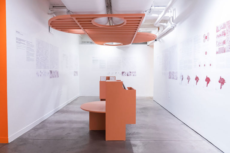
Visual Description
Photograph of a gallery room with white walls and a gray concrete floor. On the three visible walls on the left, right, and back of the room are groups of illustrations, images, and black text that are too small to read. In the middle of the room is a salmon-colored, bench-like structure. It extends through the middle of the room towards the back wall. Directly above it, a salmon-colored structure resembling a slatted pergola is attached to the ceiling.
Rationale
The Decolonizing Suburbia team selected Avondale in Cincinnati, Ohio as the ideal site for the development of an experimental toolkit for revitalizing and preserving the distinctive culture of America’s legacy city neighborhoods. While many of these neighborhoods experienced disinvestment beginning in the 1970s due to suburbanization, deindustrialization, and globalization, they have remained homes to rich ethnic cultures, often a paradoxical by-product of segregation and redlining. By decolonizing the individualistic, patriarchal, and white supremacist worldview that gave shape to these neighborhoods, the team seeks to foster just, inclusive, and collective living arrangements within “the commons,” defined as a space that offers access to shelter, food, education, civic engagement, and meaningful work for all.
A Racialized History
Though white prejudice and racial hatred have prevailed in Cincinnati since the late1800s, this borderland between slavery and freedom was initially spatially integrated. Rich and poor lived together with free African Americans, often within walking distance of stores, offices, shops, and factories. By the late nineteenth century, however, the industrializing city had become segmented along race and class lines. As residential segregation took hold, the Village of Avondale developed into a rural suburb for wealthy, primarily Protestant English and German families. In 1896, Cincinnati annexed the area and an electric streetcar system facilitated access by less affluent families. By 1920, this hilltop neighborhood had become 60 percent Jewish, with African Americans concentrated downhill in the West End, city’s first African American ghetto.
A combination of highway construction and increased migration from the South starting in 1941 brought increasing numbers of African Americans into Avondale, leading residents of North Avondale to separate themselves from the rest of the neighborhood, creating a second African American ghetto. Though segregated, the Avondale neighborhood was quite livable in the immediate post-war period, with low-income and middle-income African Americans inhabiting a mix of mostly 1930s-era detached single- and multi-family housing, laid out on generous, landscaped lots with ample front and back porches where they slept on hot summer nights. Residents did not lock their front doors, kept children’s behavior in check with threats to tell their parents, and shopped at locally owned businesses along Burnet Avenue and in small shops located here and there in residential buildings.
All this changed in 1956, when the state declared the area blighted and relocated impoverished African American families from the West End to Avondale in order to clear land for the construction of Interstate 75. In less than a decade, Avondale became the city’s second and its largest African American ghetto. Angry protests broke out in 1967 and again in 1968 as an increasingly disenfranchised population crowded into the area, trapped at the bottom of the economic ladder and disillusioned by the fading promise of the Civil Rights Movement. The destruction from these two protests only accelerated the disinvestment that had sparked them, leaving Avondale’s business district shattered and contributing to the city’s population decline and its radicalized stereotype of violence and crime.
Study Sites
To spatialize these four themes, the team identified four study sites in the neighborhood, each offering multiple opportunities for achieving the neighborhood’s vision. The four sites all border Reading Road—soon to be renamed President Barack Obama Avenue—a major arterial that runs from downtown through Avondale to the northern edge of the city. Three are located between Reading Road and where the interstate sliced through the area cutting Avondale off from its neighbor, Walnut Hills. The team chose these sites not only because they offer abundant vacant or underutilized land but also because the neighborhood’s only public transportation is located along this arterial, allowing for pedestrian-oriented small-scale revitalization.