11th Street Bridge Park
Washington, D.C.
OMA
2014–ongoing
As with many urban freeways across the United States, Interstate 295 in Washington, D.C. was built right through an historically Black neighborhood, limiting residents in Anacostia from interaction with the rest of the city. After years of neglect, the 11th Street Bridge—a now defunct vehicular bridge off the highway—fell into disrepair. City leaders advocated turning the old bridge span into a park, one that would connect long-divided neighborhoods and serve as an anchor for equitable and inclusive economic growth. OMA was hired to realize this idea and adapt the existing urban infrastructure into the city’s first elevated public park, perched above the Anacostia River.
The design’s seesaw-shaped structure aims to create a pedestrian link between the east and west sides of the river, bridging the historically entrenched divisions that dominate—disparities of income and investment that all too often align with race and are reinforced by geography. With multiple pedestrian and bicyclist access points along the stretch and in the communities on either side, the park will offer spaces for healthy recreation, environ-mental education, and the arts. As part of its planning efforts, the 11th Street Bridge Park launched an Equitable Development Plan that aspires to avoid the worst impacts of gentrification and ensure that those living there are the real beneficiaries of development.

Visual Description
A digital rendering depicts an aerial view of a river, featuring two parallel bridges that span the waterway. The bridge farther in the background is a gray two-way vehicular road with cars crossing over it. The bridge closer to the foreground is white and contains grassy areas with pathways and wide spaces. Small crowds of people dot the second bridge. Green areas line the left and right edges of the river, which extends into the background of the picture and vanishes in the distance.
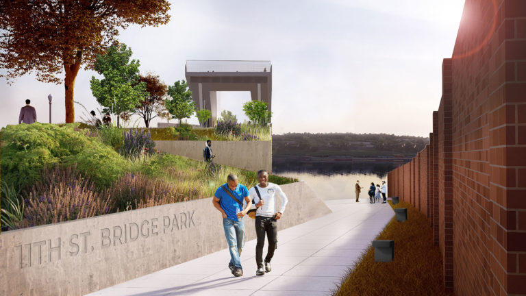
Visual Description
A digital rendering depicts a white stone path that extends from left to right, leading towards a river. Two figures on the path face the viewer and a group of people stand at the end of the path next to the river. On the left, concrete walls frame elevated plants and trees, suggesting the presence of a ramp, as a figure descends in the direction of the path along the water. Behind the foliage, an elevated pathway with a viewpoint stands atop bridge that is only partially visible, as the angle is too frontal to reveal its sides.

Visual Description
A digital rendering depicts a full-frontal view of a white paved bridge. The bridge recedes into a vanishing point in the center of the image. Large groups of people stand in the foreground observing three individuals play instruments. To the left and right of the musicians are two ramps that elevate at a slight incline to form a platform that overlooks the surrounding area. In between the elevated ramps is a central flat pathway lined by trees. A cityscape surrounds the bridge, with a highway on the right and a view of the river that the bridge crosses to the left.