by Camila Schaulson Frenz
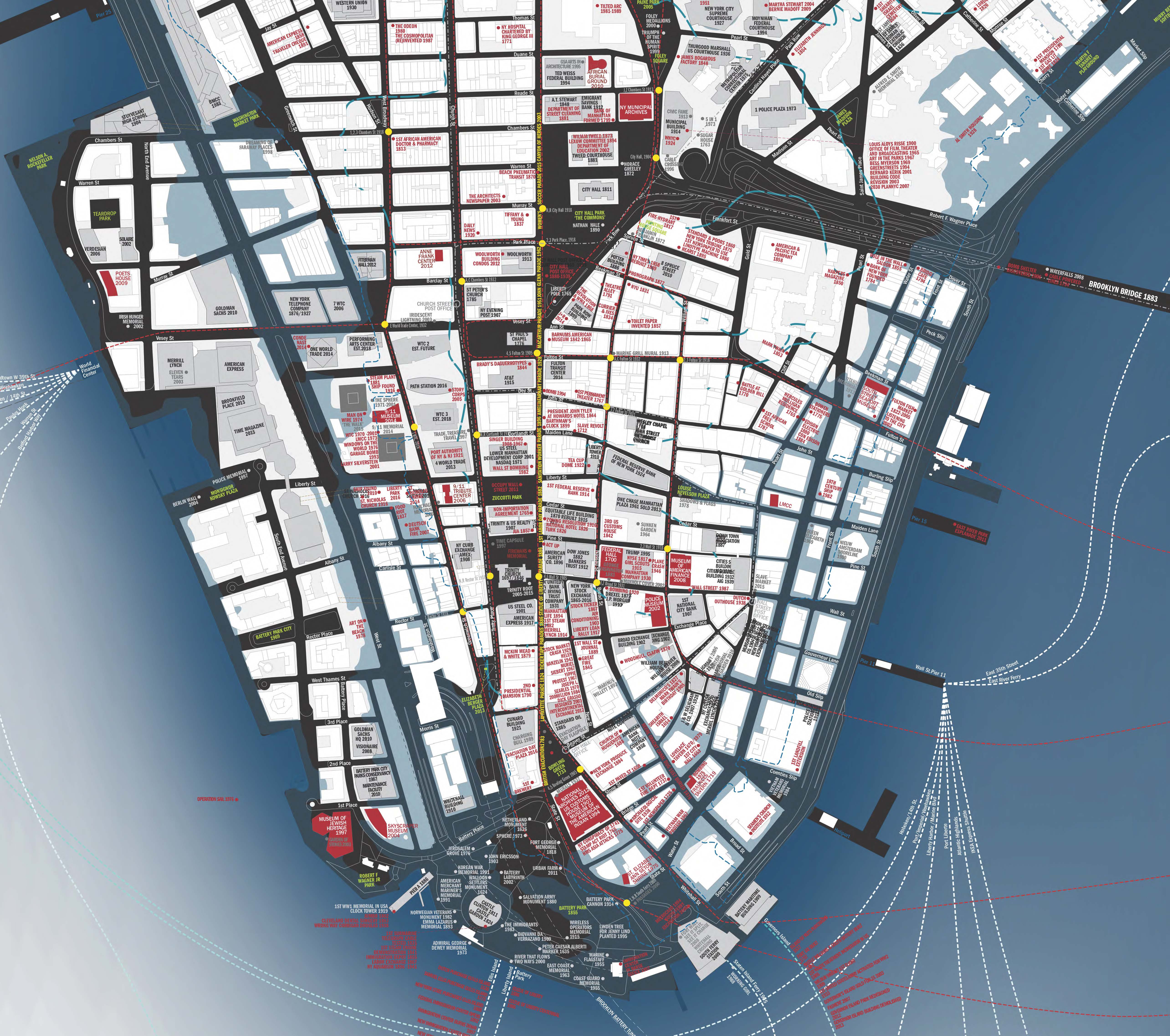
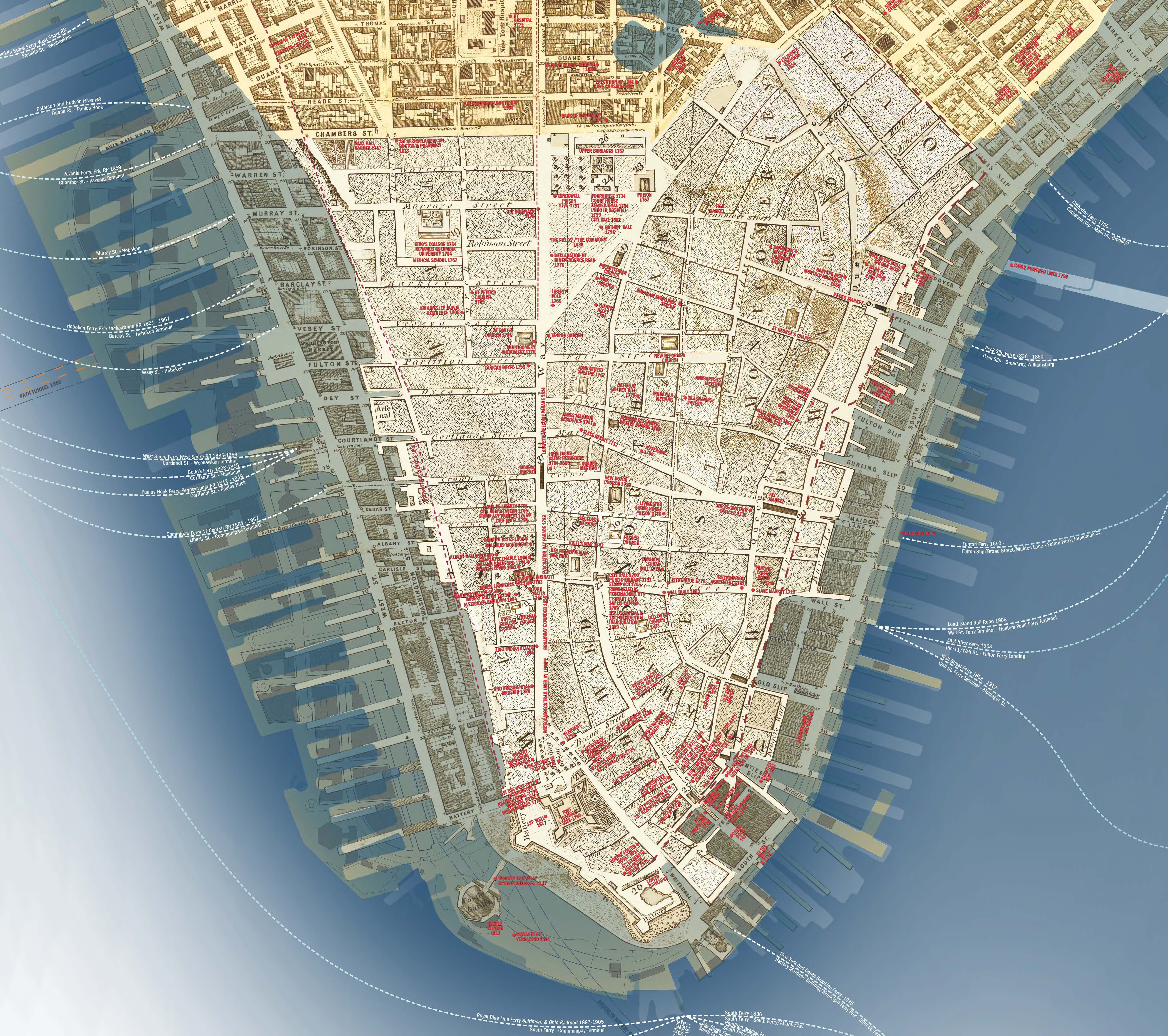
Throughout U.S. history, countless major events of local and national significance have played out in the storied streets of Lower Manhattan. CultureNOW has captured the multiple and overlapping stories woven into New York City’s life in a single document – the two-sided Lower Manhattan Then and NOW Map. The map embraces the city’s history, highlighting many of the events and places of import for the people of NYC.
Lower Manhattan Then superimposes three different historical maps that provide a snapshot of what the city looked like around 1800, 1850, and 1900. Lower Manhattan NOW describes the city as it looks today and what it might look like in the future, with an overlay of Superstorm Sandy’s surge and the projected NOAA flood zone showing 31-inch sea level rise.
Get a copy of the map this weekend! The first 10,000 maps will be available near Federal Hall on 08.13.14 from 11:00 am – 4:00 pm, courtesy of the NYC Department of Transportation. Following the launch event, maps will be available for sale for $10. Contact [email protected] for more information.