This exhibition is on view at Center at the Seaport, located at 181 Front St., as part of The Seaport Culture District.
What does the city look like from sea level?
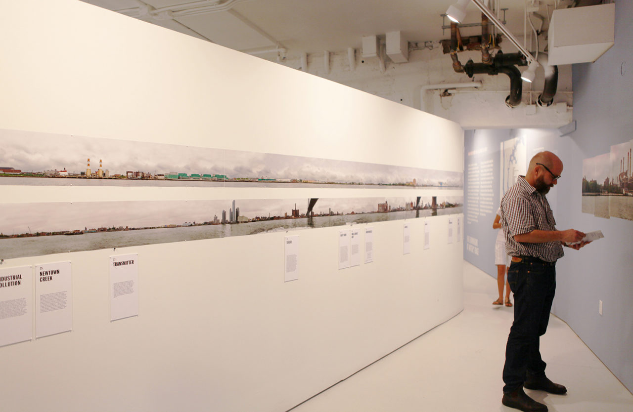
Like the government-sponsored U.S. coastal surveys of the nineteenth century, Sea Level is a water’s-eye view of New York – the city documented by photographer Elizabeth Felicella from its tidal edge. The panorama begins at Fort Wadsworth, which has, since the Revolutionary War, guarded the city and the Upper Bay of New York Harbor from the most eastern tip of Staten Island, the Narrows. It bends 25 miles north, to Fort Totten, another ancient strategic post that stands at the place where the East River ends and Long Island Sound begins. Along this trajectory through the East River, the viewer will see a shore of every borough, along with the raw geography, history, and built development that mark and characterize it. Large photographic collages will explore the construction of the panorama itself. Essays by author Robert Sullivan explore the deep history of the waterfront that is captured by Felicella’s contemporary photography.
Photography: Elizabeth Felicella
Writing: Robert Sullivan
Architecture: Andrew Berman Architect
Graphic Design: Perrin Studio
Construction: IBEX
Center at the Seaport will be open:
Monday: 12-4pm
Tuesday-Sunday: 11am-8pm
RELATED PROGRAMMING:
Opening Reception
September 10, 5:00 – 6:00pm
Conversations at Sea Level
September 10, 6:00 – 8:00pm
Brooklyn’s Shore: Tides and Time
Layered NYC
Monday, Archtober 5, 6:00 PM – 8:00 PM
Islands of Trash
Layered NYC
Wednesday, Archtober 14, 6:00 PM – 8:00 PM
Digging in the Sand
Layered NYC
Thursday, Archtober 15, 6:00 PM – 8:00 PM
Building Islands
Layered NYC
Monday, Archtober 19, 6:00 PM – 8:00 PM
Billion Year Bronx
Layered NYC
Wednesday, Archtober 28, 6:00 PM – 8:00 PM
Sea Level is presented as part of Archtober, Architecture and Design month.
-
Sponsor
Center for Architecture at the Seaport is made possible by the generous support of the following sponsor:
Classic Harbor Lines
This exhibition is on view at Center at the Seaport, located at 181 Front St., as part of The Seaport Culture District.
What does the city look like from sea level?
Like the government-sponsored U.S. coastal surveys of the nineteenth century, Sea Level is a water’s-eye view of New York – the city documented by photographer Elizabeth Felicella from its tidal edge. The panorama begins at Fort Wadsworth, which has, since the Revolutionary War, guarded the city and the Upper Bay of New York Harbor from the most eastern tip of Staten Island, the Narrows. It bends 25 miles north, to Fort Totten, another ancient strategic post that stands at the place where the East River ends and Long Island Sound begins. Along this trajectory through the East River, the viewer will see a shore of every borough, along with the raw geography, history, and built development that mark and characterize it. Large photographic collages will explore the construction of the panorama itself. Essays by author Robert Sullivan explore the deep history of the waterfront that is captured by Felicella’s contemporary photography.
Photography: Elizabeth Felicella
Writing: Robert Sullivan
Architecture: Andrew Berman Architect
Graphic Design: Perrin Studio
Construction: IBEX
Center at the Seaport will be open:
Monday: 12-4pm
Tuesday-Sunday: 11am-8pm
RELATED PROGRAMMING:
Opening Reception
September 10, 5:00 – 6:00pm
Conversations at Sea Level
September 10, 6:00 – 8:00pm
Brooklyn’s Shore: Tides and Time
Layered NYC
Monday, Archtober 5, 6:00 PM – 8:00 PM
Islands of Trash
Layered NYC
Wednesday, Archtober 14, 6:00 PM – 8:00 PM
Digging in the Sand
Layered NYC
Thursday, Archtober 15, 6:00 PM – 8:00 PM
Building Islands
Layered NYC
Monday, Archtober 19, 6:00 PM – 8:00 PM
Billion Year Bronx
Layered NYC
Wednesday, Archtober 28, 6:00 PM – 8:00 PM
Sea Level is presented as part of Archtober, Architecture and Design month.
-
Sponsor
Center for Architecture at the Seaport is made possible by the generous support of the following sponsor:
Classic Harbor Lines